Ancient City Management
Facilities


The construction of the city gates along Beijing Central Axis played an important role in managing the city during the Ming and Qing dynasties.
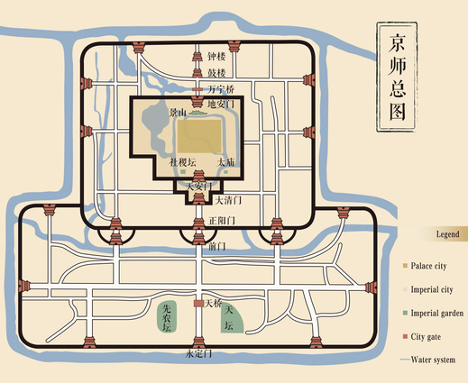
The palace and imperial cities were where the royal family lived. The Gate of Divine Prowess and the Meridian Gate, or today’s north and south gates into the Forbidden City, regulated the exit and entry into the palace city.
The inner and outer cities were where the commons lived. As the southern gates of the inner and outer cities, the Zhengyangmen and Yongdingmen gates facilitated their urban management and military defense. Both gates are located along Beijing Central Axis with higher grades than the other gates of the inner and outer cities, with more bays in width and depth, emphasizing the importance of being central.
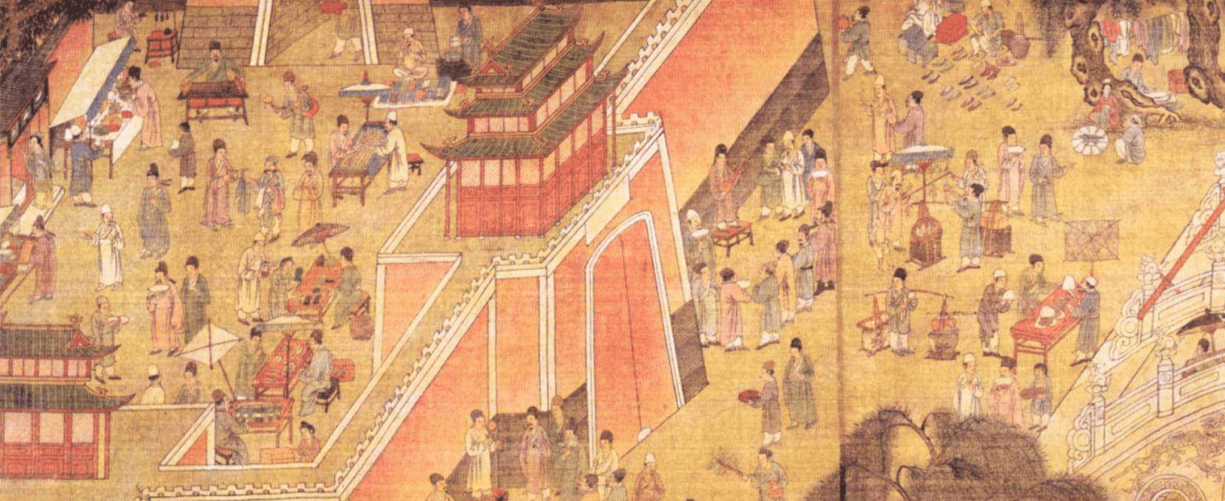
The Zhengyangmen Gate depicted in the Scenes of the Capital City of the Ming Dynasty, shows robust commercial activities inside and outside the barbican. It also shows the tightly closed gate of the archery tower, proving that ordinary people were not allowed to use it on normal days. It was preserved for the emperor and opened so he could participate in the sacrificial ceremonies.
Source: The painting is currently housed in the National Museum of China.
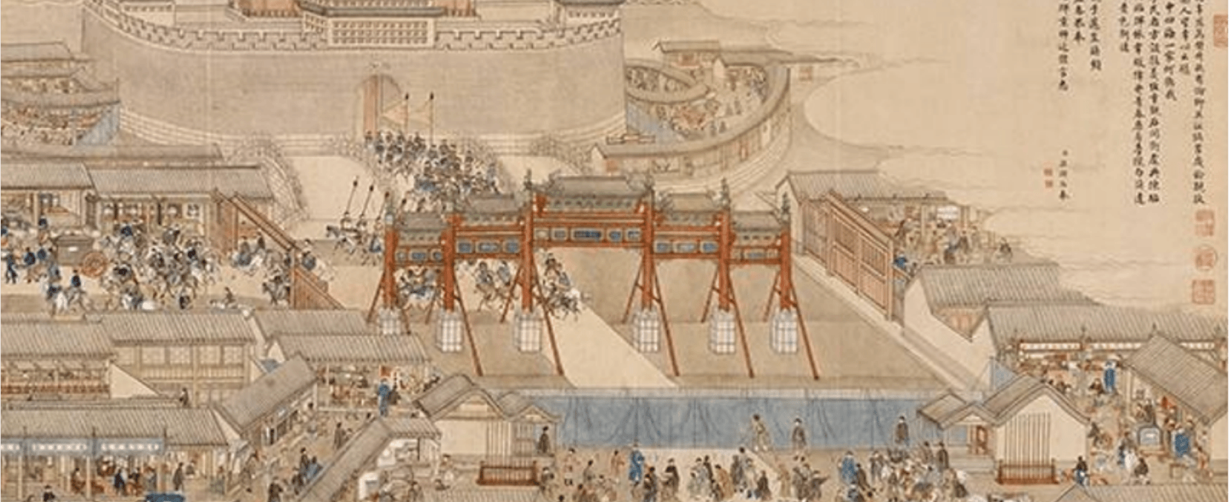
When the emperor left the imperial city, the archery tower’s gate of the Zhengyangmen Gate would open to allow the procession to pass. The area along the way would be "emptied of pedestrians and vendors’ stands." Barricades (as shown in blue in the painting) would prevent others from getting close to the procession.
Source: The painting is currently housed in the National Museum of China.
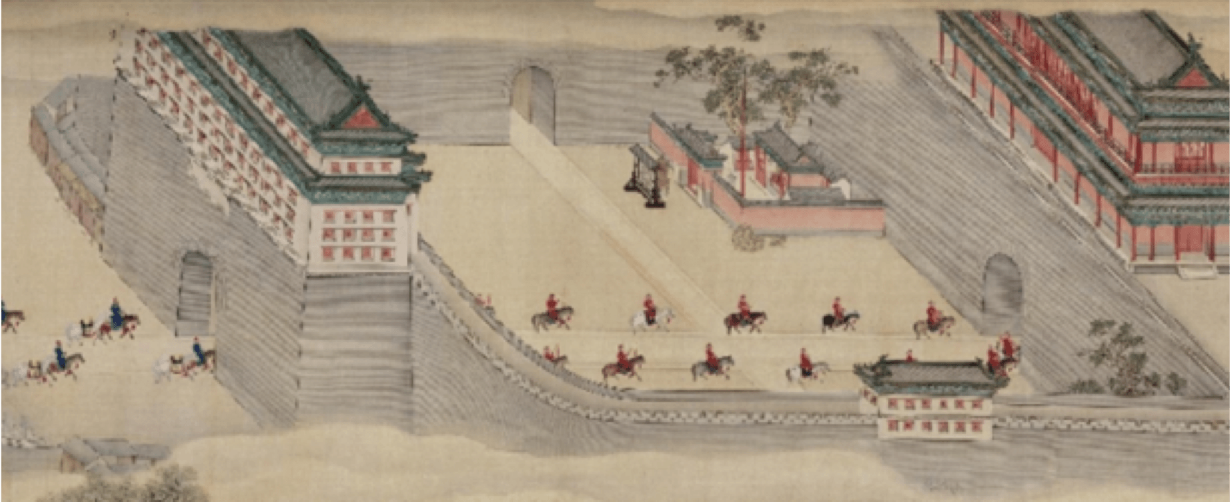
When the emperor’s entourage passed the Zhengyangmen Gate’s archery tower, its gate would open, and the stalls and stores would shutter.
Source: The painting is currently housed in the National Museum of China.
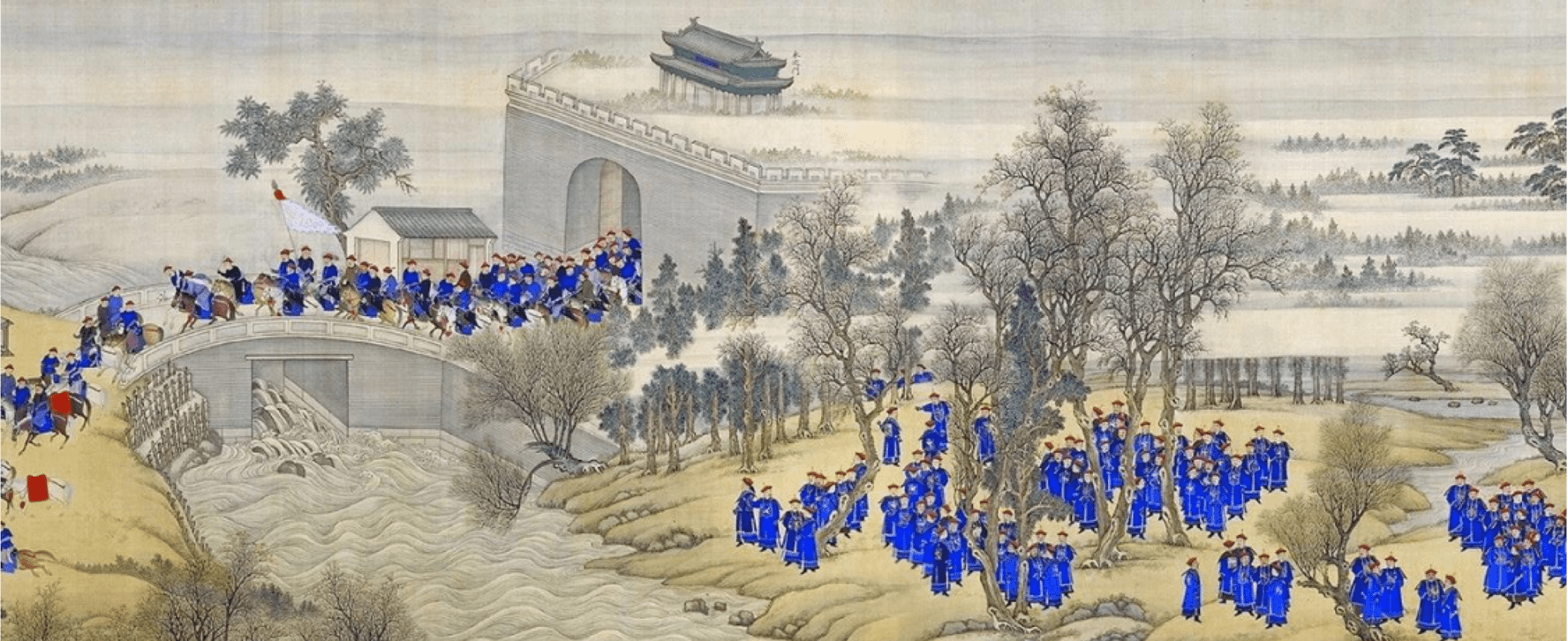
The Yongdingmen Gate was where Emperor Kangxi used to pass on his southern inspection tour. Out of the gate would be out of Beijing’s territory.
Source: The painting is currently housed in the National Museum of China.
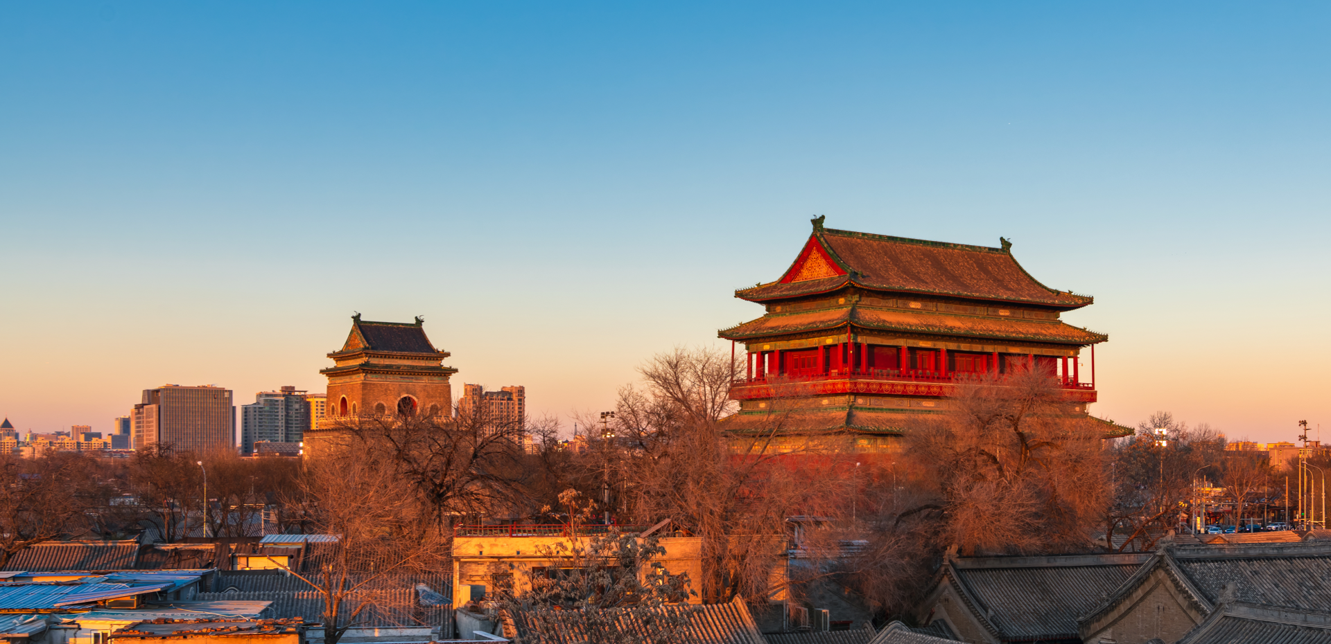
The Bell and Drum Towers were urban timekeeping facilities during the Ming and Qing dynasties. They were responsible for urban management, along with the city gates.
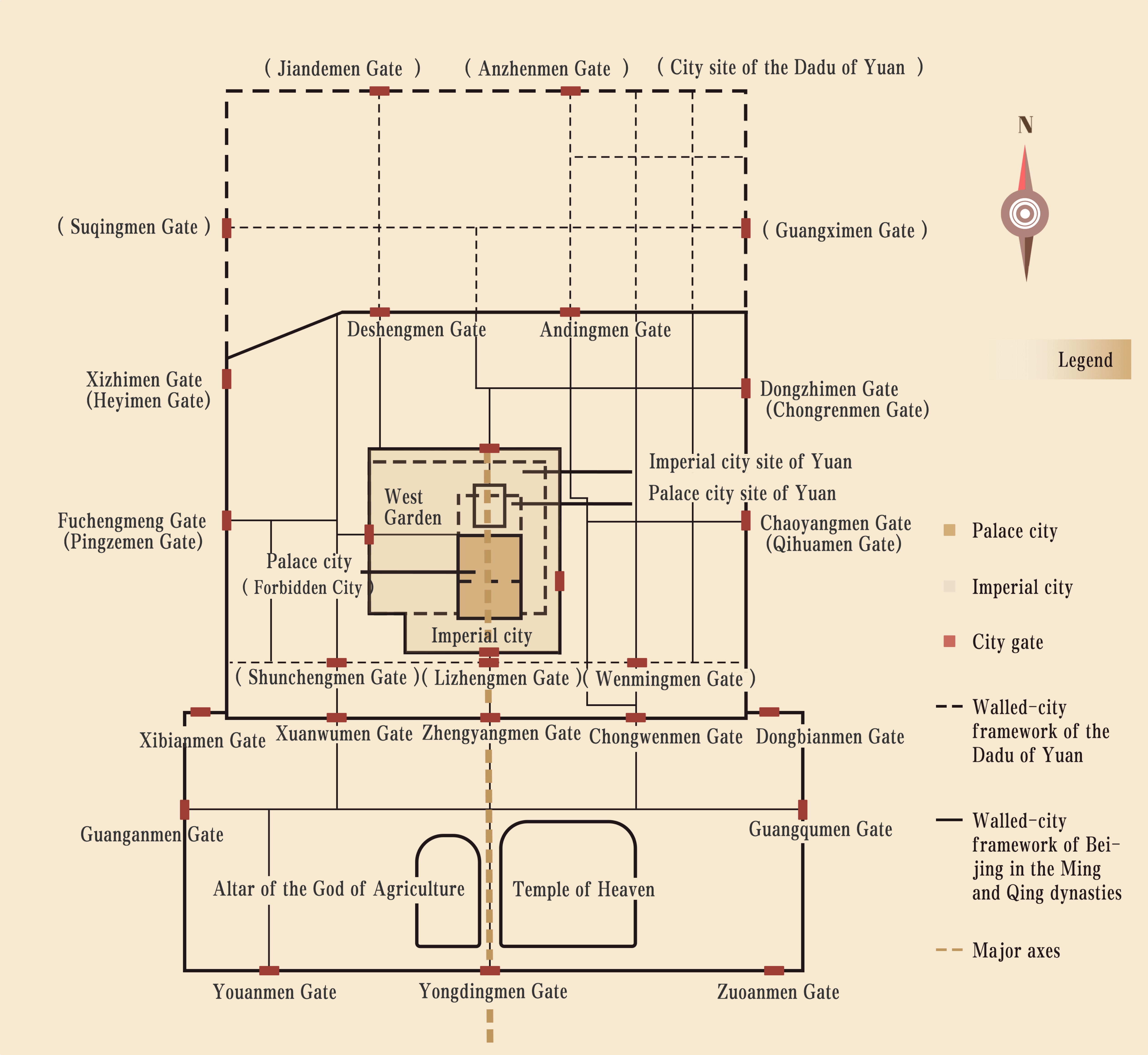
The outline of Beijing’s old city and its road pattern continuously evolved during the Yuan, Ming, and Qing dynasties.
The urban pattern of Beijing during the Yuan, Ming, and Qing dynasties
Source: transferred by Tencent
The city of Beijing was called the Dadu of Yuan in the Yuan Dynasty, and it was surrounded by three city walls, one around another, forming the palace city, the imperial city, and the outer city in the order of spreading out from the center. Therefore, the outer city encircled the imperial city, which, in turn, surrounded the palace city to reinforce the defense.
The urban roads of the Dadu of Yuan were so well-planned that they were patterned as a neat grid. In his book The Travels of Marco Polo, the eponymic Italian traveler highly praised the city as “like a chessboard, which is indescribably beautiful.” The city was divided into fifty fang (districts), each with its own gate, to facilitate the management of the residents’ daily lives.
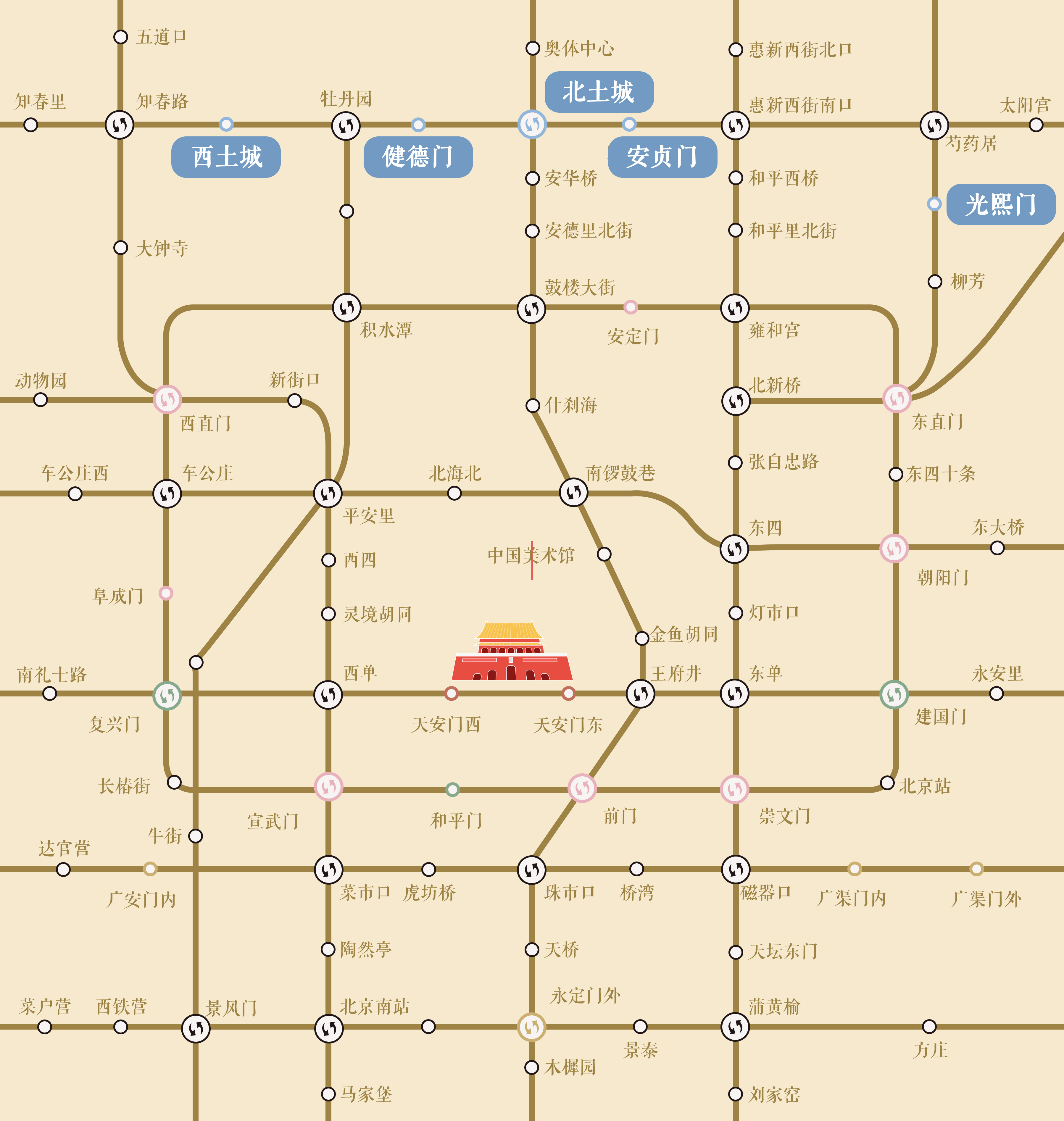
Names of subway stations related to the historical urban pattern in the Beijing subway line
The traces of urban development from the Yuan, Ming, and Qing dynasties to modern times can be found today, the most easily in the subway stations’ names. The relationship between today’s subway station names and the city outline during the Yuan, Ming, and Qing dynasties can be vividly displayed through redrawing.
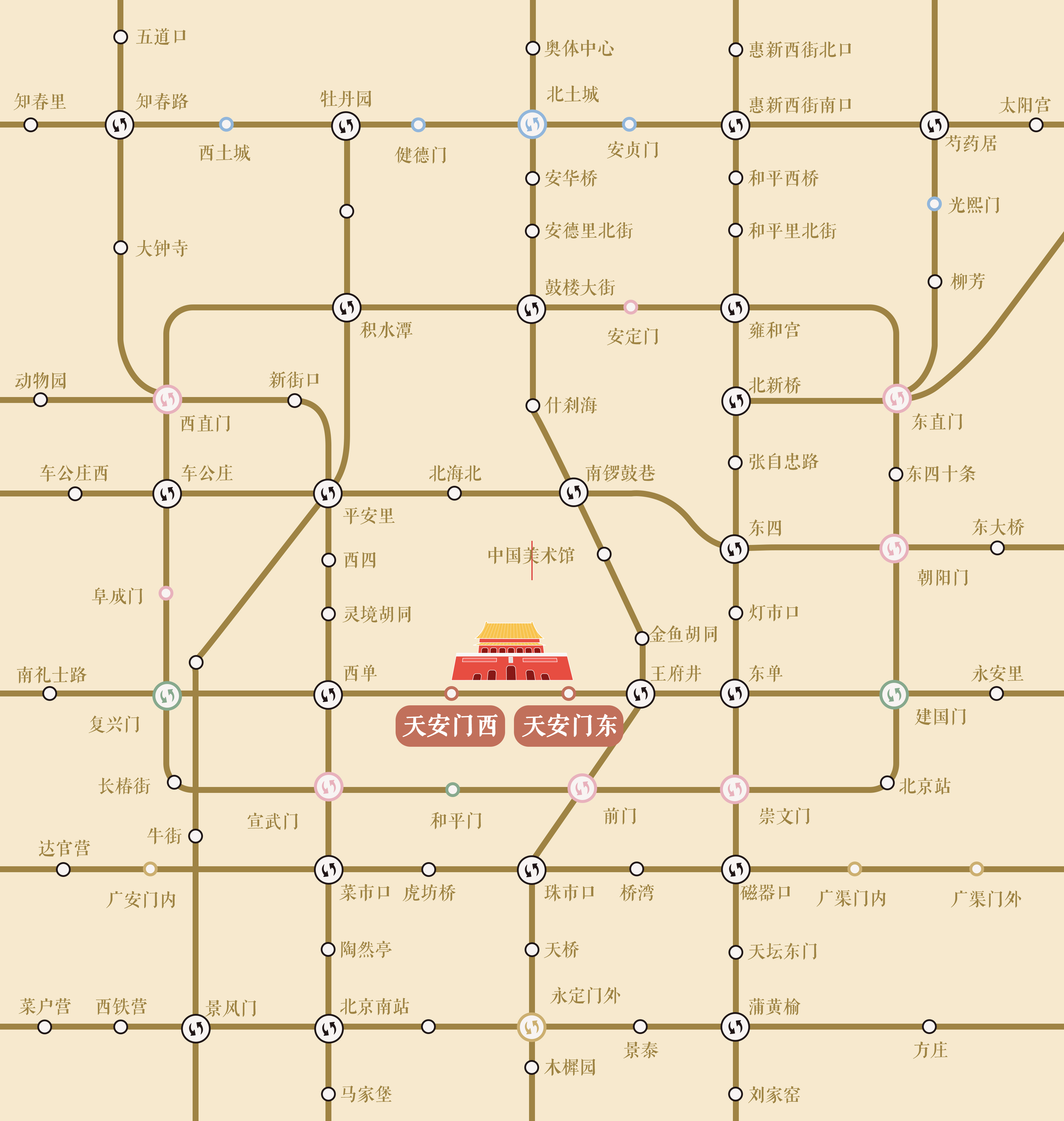
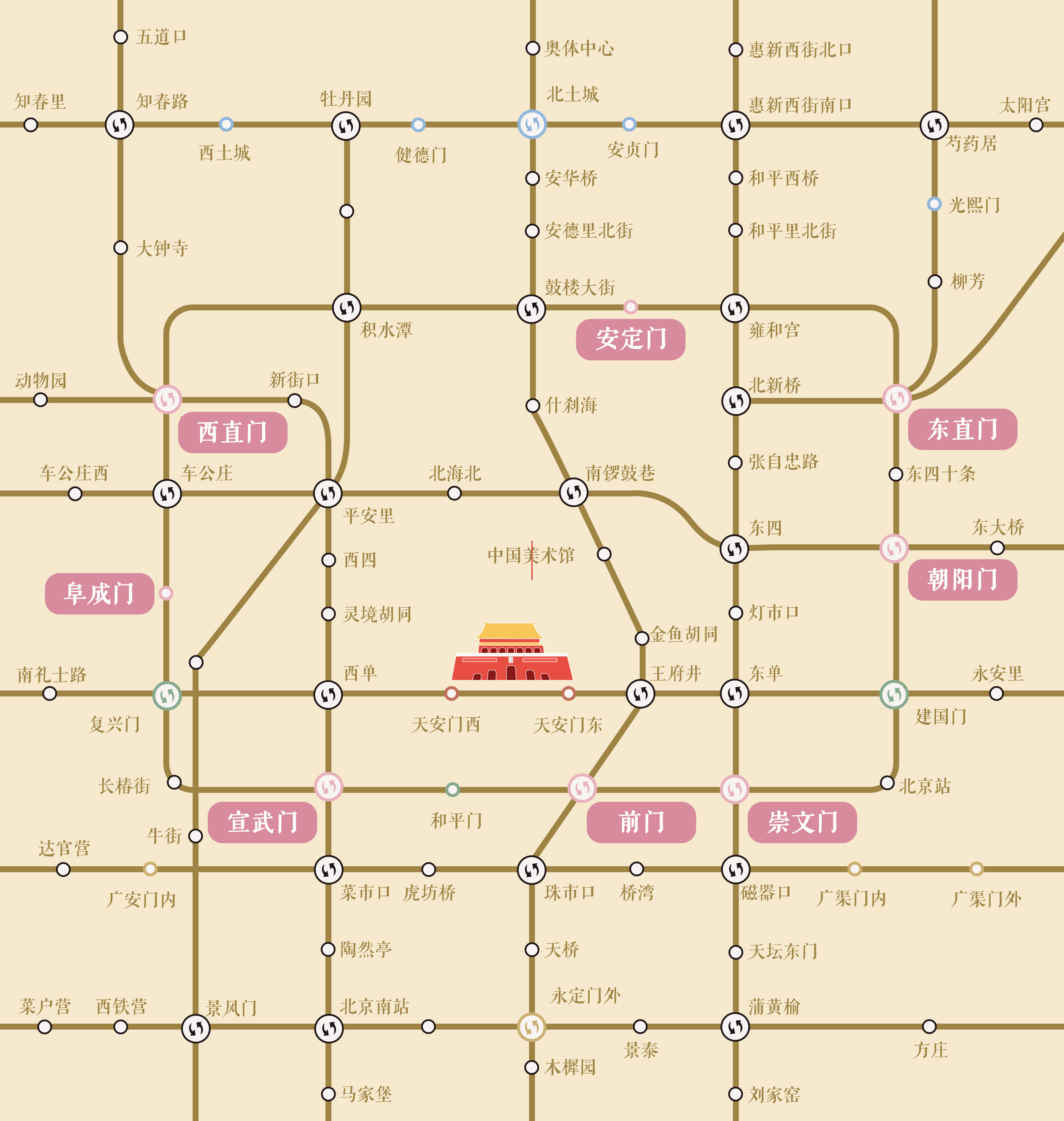
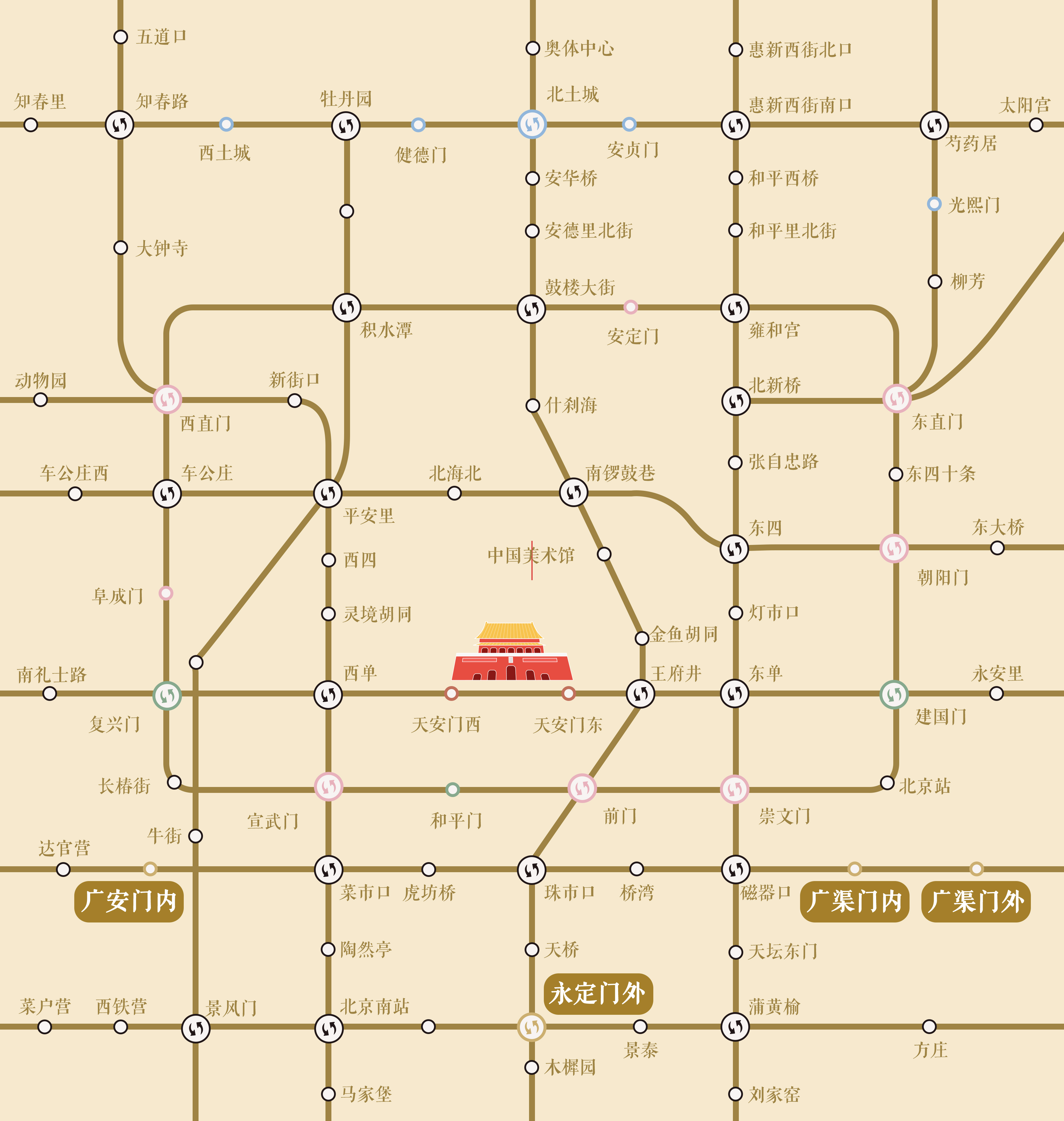
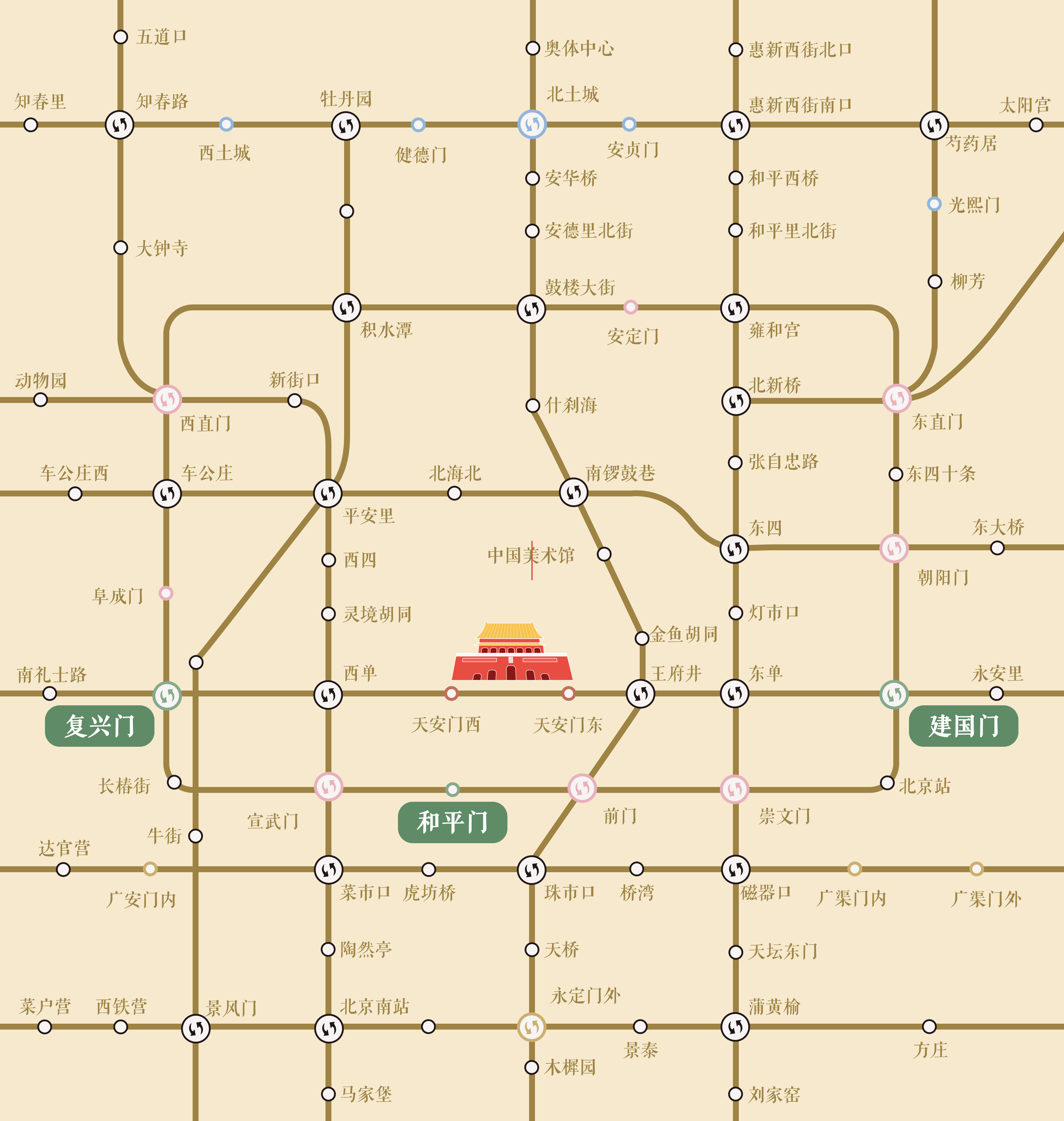
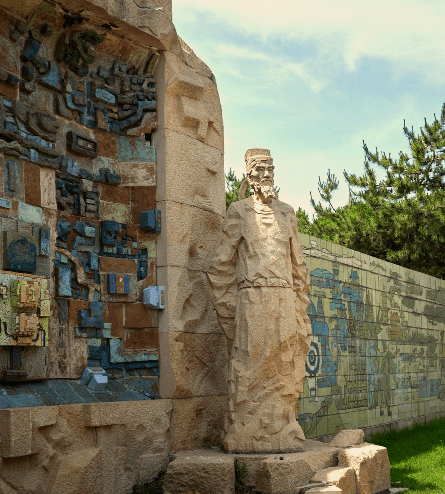
The Dadu of Yuan’s Earth City Wall Park
The Dadu of Yuan’s Earth City Wall Park is in Haidian District, containing the west section of the North wall and the north section of the west wall.
By the Ming and Qing dynasties, Beijing had evolved into a city with an urban layout consisting of the palace, imperial, inner, and outer cities, forming the Old City with the iconic 凸 shape in its plan view. Initially, Emperor Yongle of the Ming dynasty only built the inner city in the north, kept the east and west outer city walls of the Dadu of Yuan, but moved the south and north city walls to the south. The overall planning pattern of the city followed the central axis of the Dadu of Yuan. The gates were still symmetrical east to west on Beijing Central Axis. Beijing was nicknamed “A City of Four and Nine” because there were four gates in the imperial city and nine in the inner city.
With curfew imposed during the Ming and Qing dynasties, as a means of urban management, the Zhengyangmen Gate was opened and closed when the Bell and Drum Towers sounded the time to control the flow of citizens.
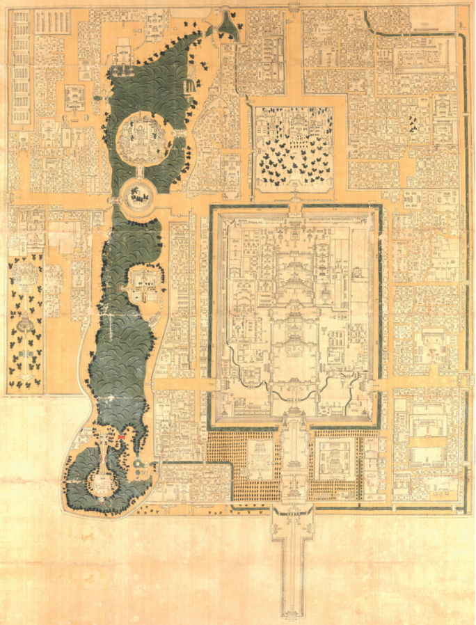
The Kangxi Era of Qing: Illustrations of the Imperial City, Palaces, and Government Offices
The scope of Beijing’s imperial city, its planning pattern, and the palace city in the Qing dynasty
Source: The Palace Museum in Taipei.
The city pattern in the Qing dynasty background shown in Illustrations of the Imperial City, Palace, and Government Offices
Source: This team of authors
